 This
is a view of the delta that was formed in Sept '96. This image was taken
April 2, 1997, shortly after our visit.
This
is a view of the delta that was formed in Sept '96. This image was taken
April 2, 1997, shortly after our visit.
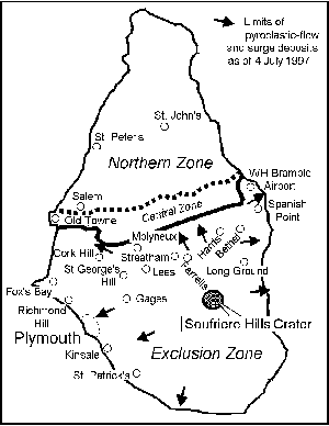
The north side of the island had been a safe zone. Now the risk map, published July 4th, shows that the previous safe zones are now at risk. The airport at which we spent several hours observing the ongoing eruption, has been covered by a pyroclastic flow.
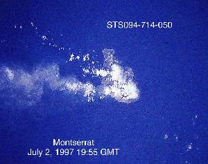 This
image was taken from the space shuttle on July 2, 1997. The island of Montserrat
is barely visible underneath the ash plume.
This
image was taken from the space shuttle on July 2, 1997. The island of Montserrat
is barely visible underneath the ash plume.
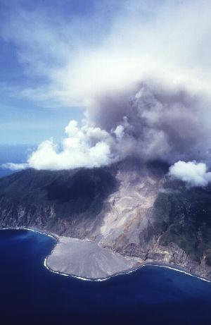
In August 1997, flows were running down the north and west flanks, and ash plumes were rising 4 - 7 km into the atmosphere. When activity slowed down enough to study the flows, it was found that they were rich in pumice.
For more information about this volcano visit: http://www.geo.mtu.edu/volcanoes/west.indies/soufriere/govt/miscdocs/chronology or,
http://www.volcano.si.edu/gvp/volcano/region16/index.htm , click on Soufriere Hills.
To find out about any other volcanoes
visit: http://www.volcano.si.edu/gvp

